|
The purpose of this exercise was to identify terrain suitable for spotted owl habitat in a canyon/plateau province of southeastern Utah. To accomplish this, I performed some basic DEM geoprocessing, condense rasters through reclassification, and calculate pixel values by combining several layers. Terrain was evaluated for suitability based on four criteria:
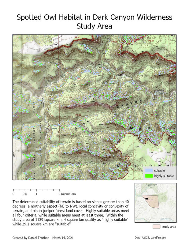 View a high-resolution PDF of the map here.
0 Comments
Leave a Reply. |
Advanced GISThis page is a repository of lab exercises produced for WATS 6920 - Advanced GIS Archives
April 2021
Categories |
 RSS Feed
