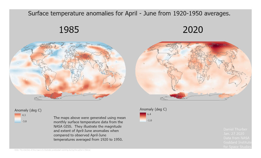
 The purpose of this assignment was to perform some basic data mining from the NASA GISS site and work with NetCDF files in Arc GIS Pro and manipulate color symbology to accurately express the trends across a range of values. The primary challenge was in re-aligning the color ramp so that:
A high-resolution PDF is available here.
1 Comment
|
Advanced GISThis page is a repository of lab exercises produced for WATS 6920 - Advanced GIS Archives
April 2021
Categories |
 RSS Feed
