|
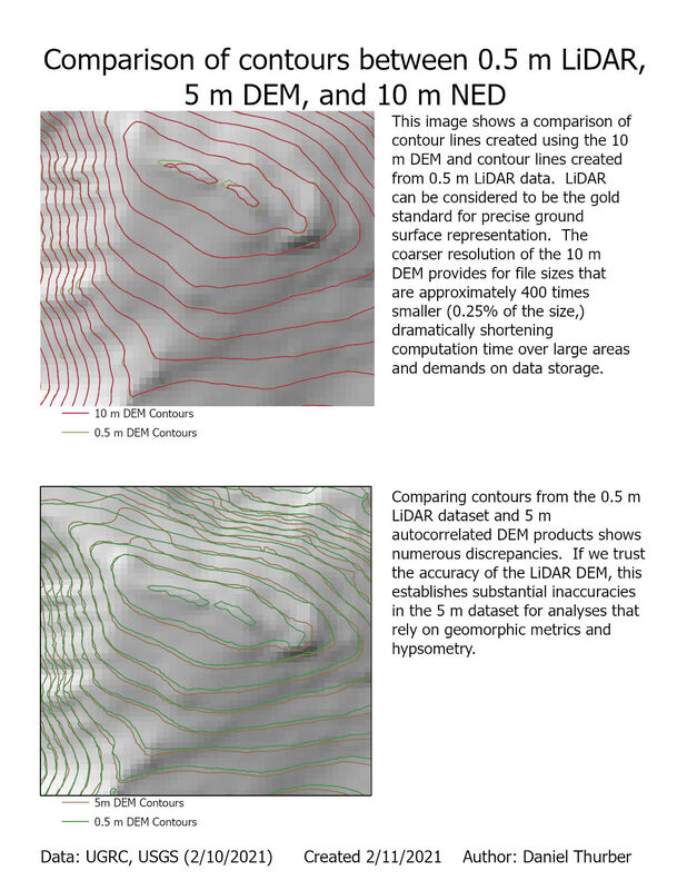
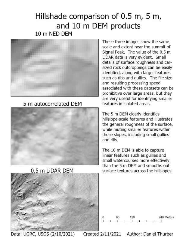
Digital elevation models (DEMs) are perhaps the most prevalent and useful applications of raster data in GIS. They represent the topography of the land surface through a gridded array of elevation points (represented as pixels). The density of these points/pixels defines the resolution of the DEM and while greater precision is fantastic, it comes at the cost of large file sizes and therefore high demands on data storage and processing speeds. Here, we compare the capacity of different sources and resolution to represent the land surface: 0.5 m LiDAR, 5 m autocorrelated, and 10 m NED DEMs. Click on each image for a high-resolution PDF of the map layout.
0 Comments
Leave a Reply. |
Advanced GISThis page is a repository of lab exercises produced for WATS 6920 - Advanced GIS Archives
April 2021
Categories |
 RSS Feed
