|
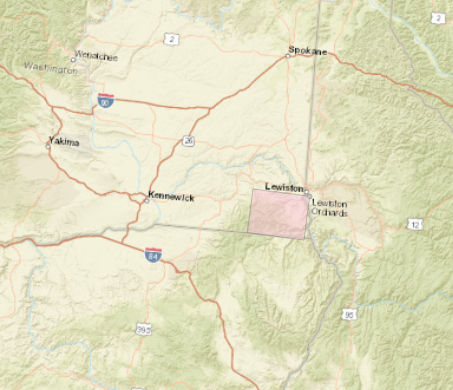
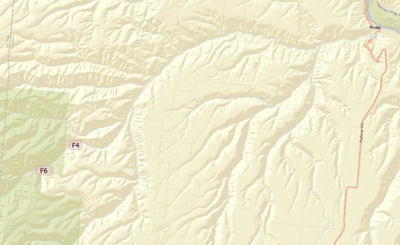
The Geomorphic Unit Toolkit (GUT) is a plug-in for ESRI ArcMap developed by Utah State University in 2017. It provides an extensive set of tools for mapping and analyzing surveys of fluvial channels. In this exercise, we are not running any parts of the toolkit, but simply looking at some of the analyses of surveyed DEMs and identifying geomorphic structures. The area of study is the North Fork of Asotin Creek in Southeast Washington, USA. The toolkit uses a taxonomic framework developed by Wheaton et. al. (2015) to identify units by their position, form, and unit type. LocationAsotin Creek flows north and east into the Snake River. The canyons are cut through the Columbia River Flood Basalt geologic province of eastern Washington. Site F6 is located upstream of F4 and both are along the North Fork of Asotin Creek. Neither site received restoration modifications during the study period.
Interpretations - Site F42.1: Qualitatively describe the in-channel geomorphology of this reach. The channel is relatively straight with a mid-channel thalweg. Small pool concavities are scattered throughout the stretch with concave troughs separating them. Some channel changes and unit shifts have occurred between 2011 and 2017, but nothing that substantially changes the character of the reaches. 2.2: Choose at least two survey years at this site to consider the temporal variability of morphology at this site. Which survey years are they and why did you choose them? I have somewhat arbitrarily chosen 2013 and 2017 2.3: What Tier 2 Forms are present in each year? Do they differ? In both years, we see bank attached convexities and mid-channel troughs and pools. Planar structures are generally limited to the margins. The positioning and occurrence of features is generally consistent between the two years, though a mid-channel convexity develops at the upstream end of the reach as shown in figure 2. 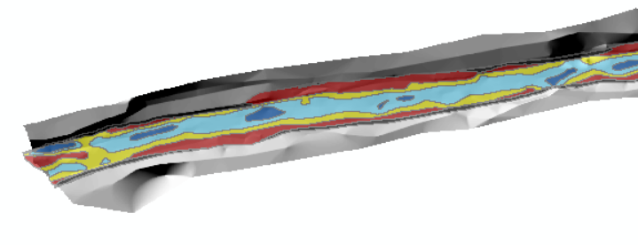 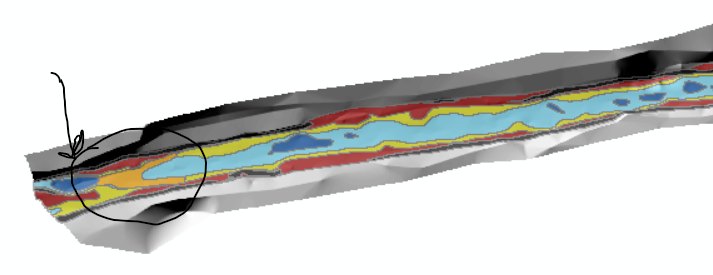 figure 2: upstream end of reach in 2013 (above) and 2017 (below) with new convexity circled 2.4: Do any of the Tier 2 Forms dominate the assemblage or is it fairly mixed? Is this true through time?
Pools and troughs are dominant in both years. 2.5: What Tier 3 Geomorphic Units are present in each year? 2.6: Zoom in to 2 to 5 x bankfull width portion of the reach and look at the arrangement of geomorphic units. Is it coherent? Does it make sense based on what you have learned so far? 2.7: How well does GUT appear to be doing in each year at discriminating the in channel geomorphic units? Point out any weaknesses or concerns you might have. 2.7: Identify in one of your surveys for this reach a distinctive pool, bar and planar feature. For all three identify all five attributes from the fluvial taxonomy (i.e., Table 6), then use those to identify the tier 3 name from Table 7 or 8 (this may differ than what GUT output is because it is not as resolved) and explain which attribute(s) were key for discriminating that unit from other units.
0 Comments
Leave a Reply. |